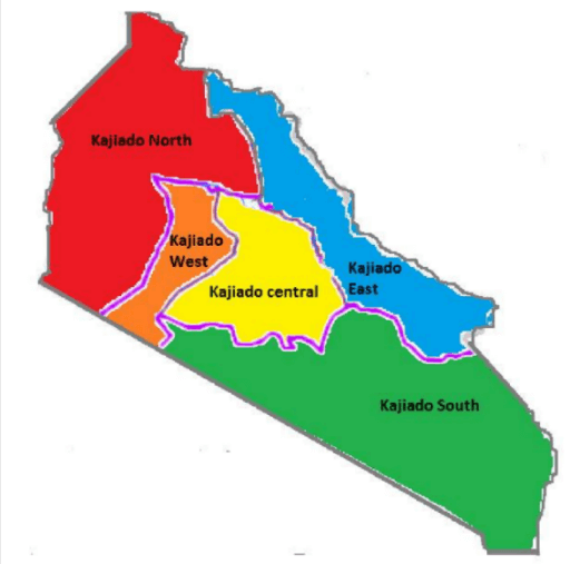
Kajiado County covers an area of 21,901 km² with a population of 1,117,840 according to the 2019 census. The region is largely arid and semi-arid, with some fertile areas in Ngong and parts of Kajiado North. The county has 5 sub counties (Kajiado Central, Kajiado west, Kajiado East, Kajiado South, Kajido South). Key geographical features include Lake Magadi, the Ngong Hills, and Amboseli National Park. Urbanization is significant, especially in Kajiado North, which borders Nairobi. The county is predominantly inhabited by the Maasai, along with Kikuyu, Kamba, and other communities.
The county’s economy is heavily reliant on livestock farming, with pastoralism being a central part of life for many residents. Mining activities are also notable, particularly soda ash extraction at Lake Magadi. Urbanization and real estate development have grown in areas like Ongata Rongai, Kitengela, and Ngong due to their proximity to Nairobi. Kajiado is part of the Narok-Kajiado Economic Block (NAKAEB) that aims to enhance economic development.
Health and development challenges persist in Kajiado County. Teenage pregnancies and early marriages are common, and access to healthcare is uneven, with remote areas facing significant gaps in facilities and services. The County has 395 health facilities spread out across the 5 sub-counties with 23(5.8%) being faith-based, 118 (29.9%) government, 9 NGOs (2.3%), and 245(62%) being private. Literacy rates in the county are improving, although gender disparities in school enrollment persist. While infrastructure development is more advanced in urban centers, rural areas lag.


